Kaya
Centre-Nord, Burkina Faso
cityPop: 122 94913.0833, -1.0833
Flights to Kaya Area - Ouagadougou International Airport
OUATo travel to Kaya, fly to Ouagadougou International Airport (Ouagadougou, BF), located approximately 93.18 km away.
Hotels & Rentals
Explore accommodation options near Kaya
Weather
Kaya, Burkina Faso
Local time: 2026-07-18 13:41
38°C
Feels 31°C
Sunny · Wind 14 kph · Humidity 31%
Sat, Jul 18
25° / 39°
Sunny
Sun, Jul 19
26° / 34°
Sunny
Mon, Jul 20
22° / 29°
Sunny
Fresh · TTL 1800s
Currency
In Burkina Faso the currency is XOF. 10 USD ≈ F CFA 5,736 as of today.
Rate: 1 USD ≈ F CFA 573.6
Closest Airport
OUA
Ouagadougou International Airport
Ouagadougou, BF
93.18 km
Videos closest to Kaya
12:00
92.64 km
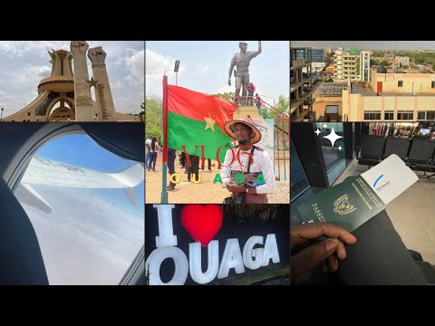
5 Unforgettable Days in Ouagadougou, Burkina Faso
Abdel Nassir
15790Ouagadougou, Burkina Faso

1:20:09
368.41 km
18-Hour Road Trip from Accra to Jirapa & Wa, Ghana | Vlog
Tatiana Haina
15275Wa, Ghana

1:00
429.11 km
Exploring Tata Somba: UNESCO Site in Kouandé, Benin
Tim Webb
Tata Somba, Kouandé, Benin

10:27
577.92 km
Birnin Kebbi: Sights & Sounds of Kebbi State – Vlogmas 3
African Storyteller
4339Birnin Kebbi

1:42
577.92 km
Discover Birnin Kebbi Substation & Surrounding Areas
WAPP North Core Project
611Birnin Kebbi

9:26
577.92 km
Kebbi State NYSC Orientation Camp Tour | Vlog #1
Mopelola Ukpai
369Birnin Kebbi

1:00
685.48 km
Cinematic Drone Views of Sokoto Cement Factory Pit, Nigeria
Jibril Aminu
Sokoto, Nigeria

6:26
685.48 km
Where the Road Leads: Episode 2 - Sokoto, Nigeria
Dave ENDA
Sokoto, Nigeria

13:01
686.82 km
Discover Islam, Culture & Life in Sokoto: Hausa-Fulani Dance, Cuisine & Traditions
Edward Wonder
Sokoto

8:02
708.68 km
Kumasi, Ghana: Discover the Side You Haven't Seen
Africa News World
Kumasi, Ghana

22:40
708.68 km
Kumasi Travel Tips: Essentials Before You Visit
PAKORICH STUDIOS
Kumasi

9:52
708.68 km
Drone Footage over Kumasi, Ghana 2021 - Part 21
Africa Travelling
4795Kumasi, Ghana
Places closest to Kaya
Korsimoro
Centre-Nord, Burkina FasocityPop: 18 875
28.63 km
Pissila
Centre-Nord, Burkina FasocityPop: 23 420
30.34 km
Kongoussi
Centre-Nord, Burkina FasocityPop: 53 641
56.07 km
Ziniaré
Plateau-Central, Burkina FasocityPop: 33 296
60.11 km
Boulsa
Centre-Nord, Burkina FasocityPop: 24 200
71.20 km
Bourzanga
Centre-Nord, Burkina FasocityPop: 27 213
82.72 km
Mogtédo
Plateau-Central, Burkina FasocityPop: 25 699
92.57 km
Ouagadougou
Centre, Burkina FasocityPop: 3 063 271
92.62 km
OUA
Ouagadougou International Airport
Ouagadougou, BF
93.18 km
Mani
Est, Burkina FasocityPop: 15 066
96.73 km